")
")
")
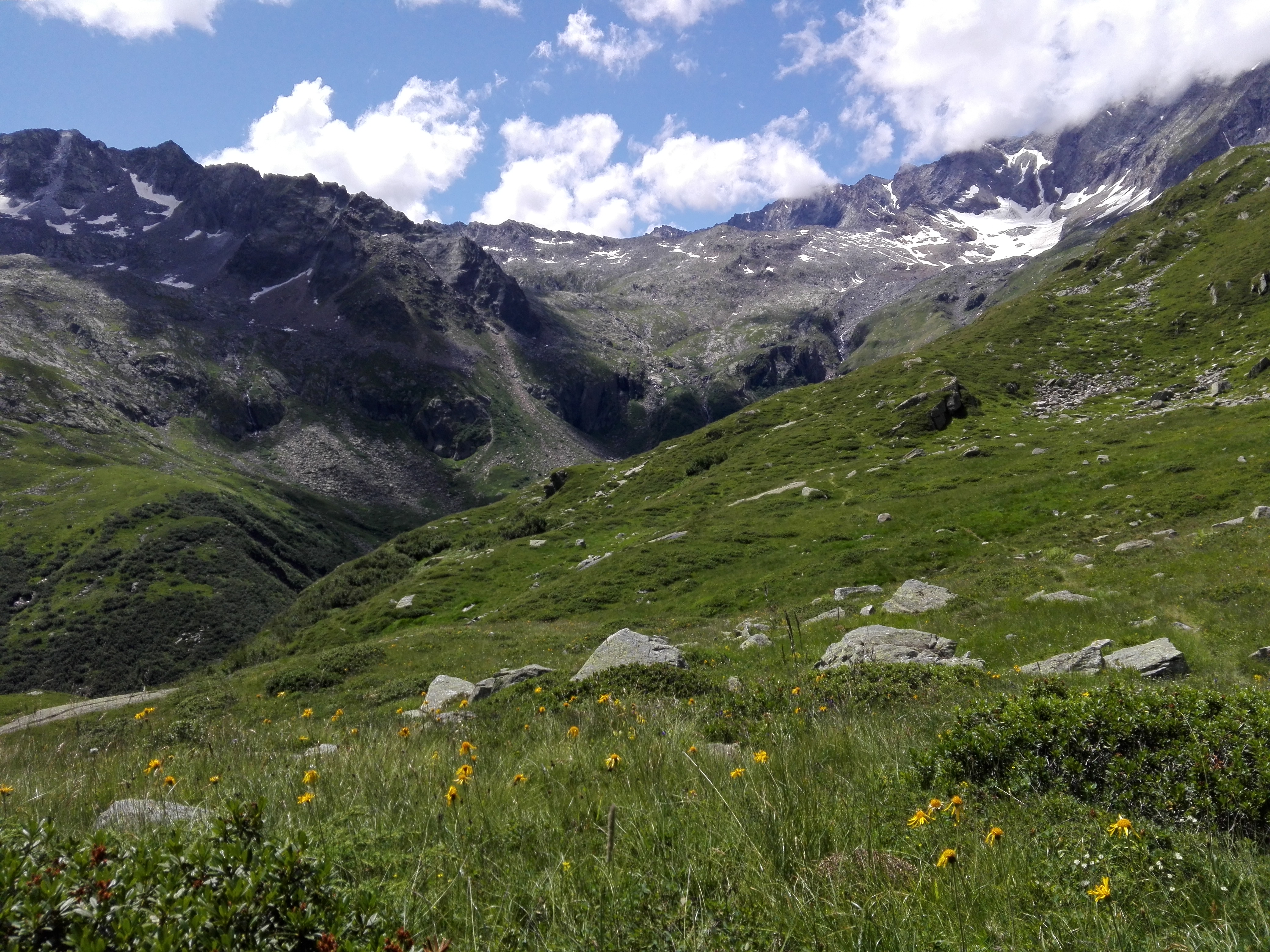
From Piazza dell’Oratorio in Cheggio, take the street that leads to the cableway landing near the dam. Just before the dam, keep the trail for the Preia Pass (with SI, or Grand Italian Trail, signs) on your right to continue on and cross over the dam wall to reach the first junction for Alpe Fraccia and Forcola Pass, and then the second crossroads with a water “fountain”. After having crossed a wood bridge, you’ll come to characteristic area surrounding a crucifix. From there, continue on to the end of the lake, cross the bridge over the Loranco stream and then climb up to the beautiful panoramic viewpoint of Alpe del Gabbio. After leaving the fork for the “Giro lago” (river loop) to your right, arrive at the Chapel of Alpe Piana Ronchelli. Hike slightly uphill and after passing the junction for Alpe Campolamana (stay on the current trail, don’t change trails) you’ll reach the Alpe, situated in a beautiful clearing. From this mountain pasture, keeping the trail for the Lakes of Pozzoli and the “Ponte Tibetano” (Tibetan Bridge) on the right, climb up the hillside of the valley until Alpe Camasco. After seeing the small chalets sheltered from avalanches, cross the stream and start climbing again until descending into the vast grasslands of Alpe Andolla. You will soon reach a mountain hut with the same name. The return route is the normal road that goes from Alpe Piana Ronchelli to Alpe Gabbio and finally returns to Cheggio.
Notes: This itinerary is a path of discovery into wild areas of the park, high altitude meadows in sight of large, rugged mountains from the Pizzo Andolla range. Lake Cheggio (or Bacino dei Cavalli) is a characteristic turquoise colour. The Andolla refuge, owned by the CAI di Villadossola, is a well maintained mountain hut open in summer.
Last update: 06/03/2018 ore 15:09:54


