")
")
")
General features:
Hiking itinerary that winds on mountainside from Villadossola to the Sacro Monte Calvario (UNESCO World Heritage Site) and continues up to Bognanco on historic stone roads. A dive into the past that allows you to read the landscape of the ancient mountain agricultural economies around the Ossola plain.
The route:
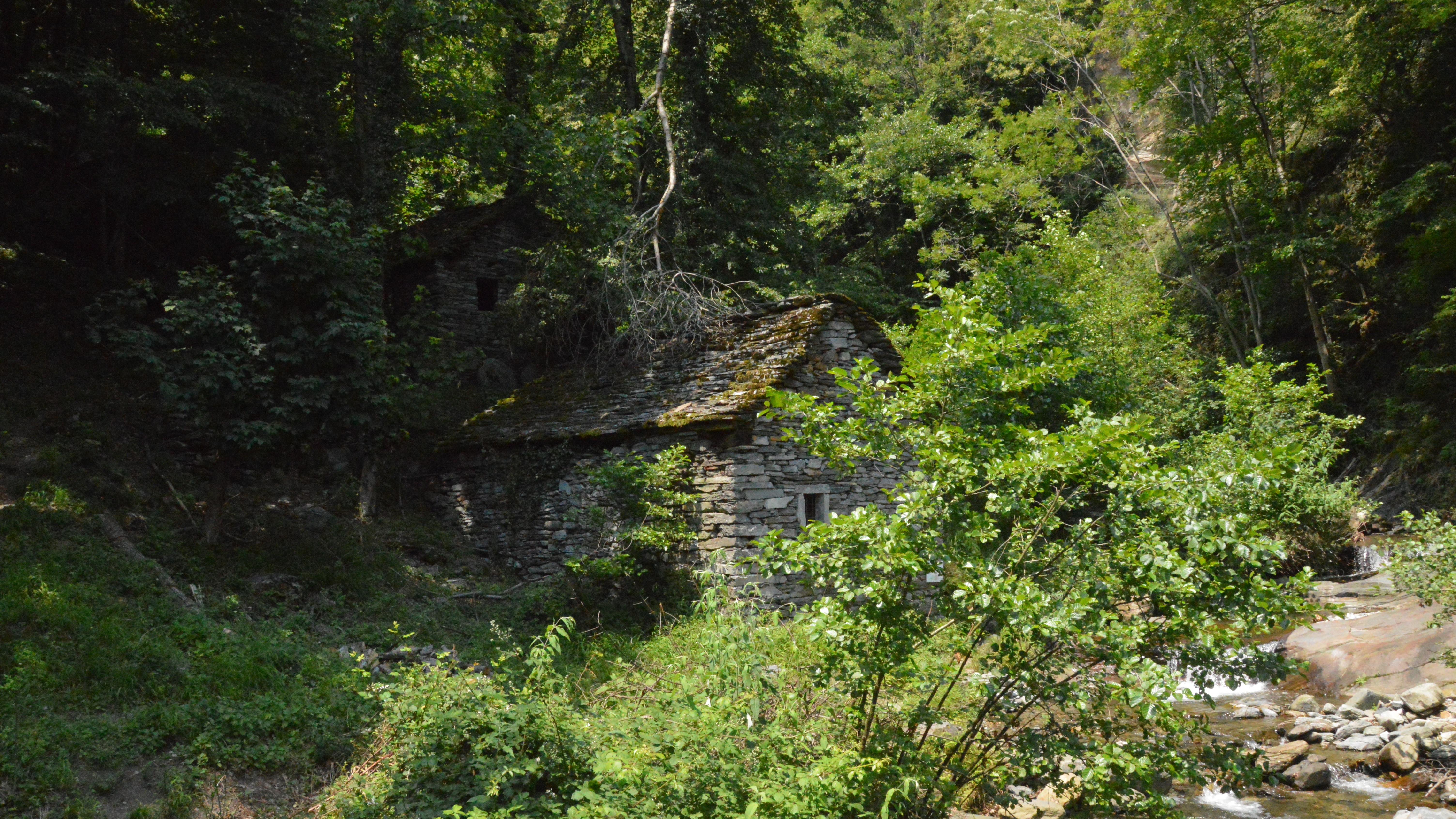
From the station, take the central Corso Italia until you cross the stone bridge over the Stream Ovesca. From Piazza IV Novembre follow Via Croppo and immediately Via Pioda. A staircase leads to Cà dei Conti, where you continue on the path towards the hamlet Boschetto, and then along an aqueduct to the megalithic site of Varchignoli. Continue to the right (signpost "Via torchi e dei mulini"). Pass the hamlet of Sogno. Shortly after, cross the Brook dell'Inferno and continue up and down to the Alpe Maianco Inferiore, and then through vineyards to Tappia. Continue among the chestnut trees towards the Chapel dell’Oro, a panoramic point. The passage of the Brook dei Mulini precedes the arrival in Anzuno, with the Oratory of San Antonio da Padova, over the Toce Valley. Go down passing on a beautiful mule track up to Crosiggia among the vineyards of "Prunent", the typical Ossola grape. Reach Sacro Monte Calvario (UNESCO Heritage) with a short ascent on asphalt. Descent to Domodossola along the shady Via Crucis.
Area: Plain of the Ossola Valley
Itinerary particularly suitable for educational visits www.sacri-monti.com
On the website are available very in-depth teaching materials related to this path.
Notable Items along the Track
Sacro Monte Calvario di Domodossola, Borgo di Domodossola, Church of San Bartolomeo in Villadossola, traditional rural architecture
Accesso con mezzi pubblici
By train: Villadossola station, Ferrovie dello Stato. Timetable: http://www.trenitalia.com/; www.ffs.ch By bus: bus to Villadossola, Circular South line; or Domodossola - Pieve Vergonte line; or Domodossola - Antrona line. Timetable: www.vcoinbus.it By car: A26 motorway towards Gravellona Toce, from here SS33 del Sempione, before arriving at Domodossola, exit for Villadossola